Kawartha Conservation - Watershed Conditions Statement - Flood Outlook - March 13, 2026
Kawartha Lakes - Kawartha Conservation has downgraded their Flood Watch to a Watershed Conditions Statement - Flood Outlook for the Kawartha Lakes region until 12pm on Monday March 16, 2026.
WATERSHED CONDITIONS STATEMENT - FLOOD OUTLOOK
DATE: March 13, 2026
TIME: 11:15AM
Message sent on the basis of information received from:
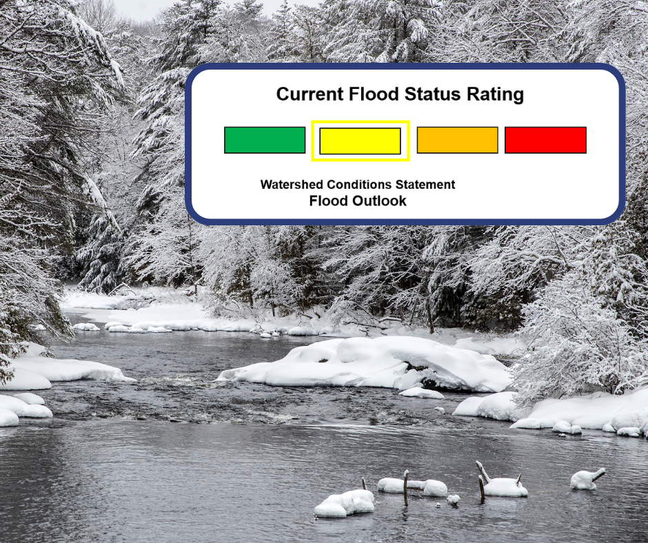
Based on current watershed conditions and the most recent weather forecast, Kawartha Conservation is downgrading the current Flood Watch to a Watershed Conditions Statement – Flood Outlook for the Kawartha watershed through to 12pm on Monday March 16, 2026.
Watercourses across the municipality, with the exception of the Burnt and Gull Rivers, continue to gradually recede following last week’s rainfall and accelerated snowmelt. While water levels remain elevated in some areas, widespread flooding is not anticipated at this time.
The current forecast indicates 10 to 15 cm of snowfall over the next three days. This snowfall is expected to temporarily slow runoff and stabilize water levels. However, additional rainfall and warmer temperatures forecast for Monday may result in renewed snowmelt and increased runoff early next week.
Ground conditions across the watershed remain saturated, and rivers, streams, and watercourses are flowing above seasonal norms. As identified by the Ministry of Natural Resources – Surface Water Monitoring Centre, any rainfall combined with warming temperatures could produce additional runoff and localized increases in water levels.
Flooding of low-lying areas, floodplains, and areas adjacent to watercourses is not expected to be widespread, but localized pooling and minor flooding remain possible. Smaller tributaries and urban drainage systems may respond quickly to rainfall and snowmelt.
Ice cover on lakes and rivers will continue to weaken as temperatures fluctuate. Ice movement may occur in areas with a history of ice jamming, which can cause sudden and unpredictable rises in water levels.
Residents in flood-prone areas are encouraged to monitor local conditions and remain prepared. Kawartha Conservation advises residents to exercise caution near all watercourses and reminds parents and pet owners to keep children and pets away from rivers, streams, and ponds. Water levels remain high, riverbanks may be slippery and unstable, and flows continue to be hazardous.
Northern tributaries such as the Burnt River and Gull River are monitored by staff from the Ministry of Natural Resources. Residents along these rivers are requested to direct any questions concerning water levels to the Minden Area Office at 705-286-1521 or refer to current flood messages issued by the Ministry of Natural Resources.
Kawartha Conservation will continue to monitor watershed and weather conditions closely and remains in communication with municipal partners, the Trent-Severn Waterway, the Ministry of Natural Resources – Surface Water Monitoring Centre, and neighboring Conservation Authorities. Updates will be provided as conditions warrant.
If you are aware of or have concerns about flooding, please contact Kawartha Conservation at 705.328.2271 or 705.344.0155 after hours.
This Watershed Conditions Statement – Flood Outlook will remain in effect until 12pm on Monday March 16, 2026, or will be updated or rescinded as required.
Watershed Conditions Statement - Flood Outlook is an early notice of the potential for flooding based on weather forecasts calling for heavy rain, snow melt, or other conditions that could lead to high runoff, ice jams, lakeshore flooding, or erosion.
Contact Us
Kawartha Lakes
P.O. Box 9000, 26 Francis Street
Lindsay, ON, K9V 5R8
Telephone: 705-324-9411
Toll free at 1-888-822-2225
After-hours emergencies: 1-877-885-7337


